


A Travelers Guide to the Corsica GR20 - From Calenzana to Vizzavona in 9 Days
- allannahtravels
- Aug 27, 2018
- 25 min read
Updated: Dec 13, 2019

Corsica, commonly referred to as a “mountain in the sea”, is an unfamiliar island situated between Sicily and the southern coast of France. It is home to pristine beaches, unique wildlife, awe-inspiring mountain scenery, and of course, Europe’s toughest long-distance hike – the GR20.
GR20 stands for the twentieth “Grande Randonnee” in French, which translates simply to “Great Trek”. The GR20 is a 180km-long hike that traverses the length of Corsica from northwest to southeast (Calenzana to Conca) and includes a height variation of approximately 10,000 metres. The steep and rugged terrain is typically journeyed in 15 days, and takes you through towering pinnacles, deep forests, windswept craters, glacial lakes, and snow-capped peaks, rarely losing sight of the dramatic Corsican coastline.
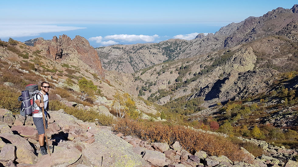
Many who take on this route claim to have seriously underestimated its nature – and we were no exception. Ben and I hiked from Calenzana to Vizzavona, approximately 100km and half the overall GR20 trail. We completed this section of the trail in 9 days during the off season, which meant that huts were closed for winter and food stores were scarce. But regardless of the day to day challenges, most of our time was spent absolutely mesmerized by the diverse scenery and feeling so grateful to have explored a place that not many would dare. This blog provides details of our experience along the GR20, including our itinerary and what we packed, to encourage you to explore this incredible island yourself.
Hiking the GR20

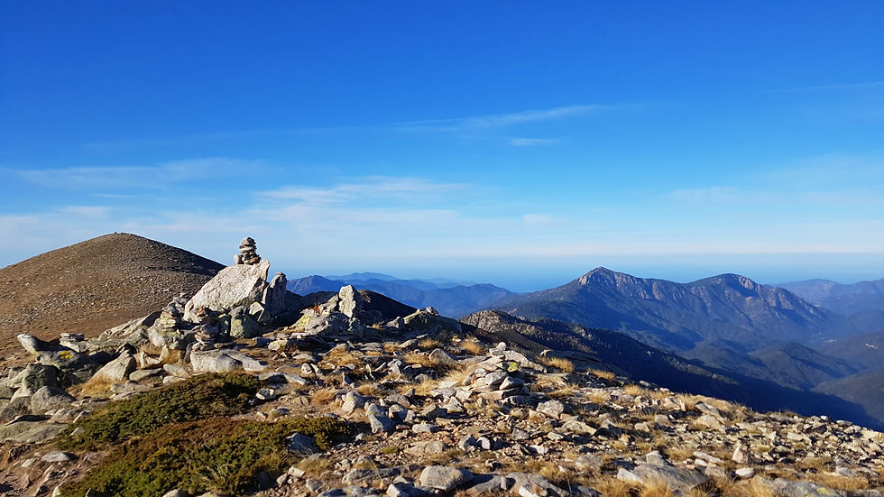
Stage One – Calenzana to Refuge d’Ortu di u Piobbu
Distance: 12km
Ascent: 1550m
Descent: 235m
Time: 7 hours
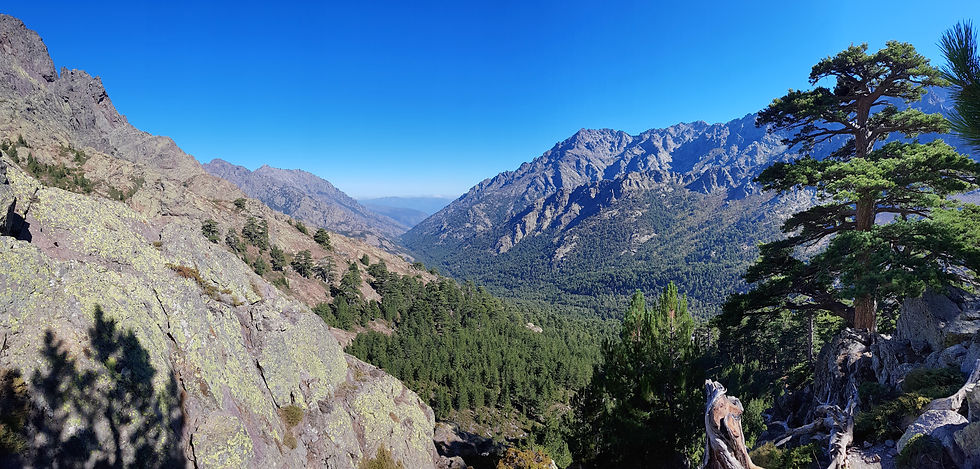
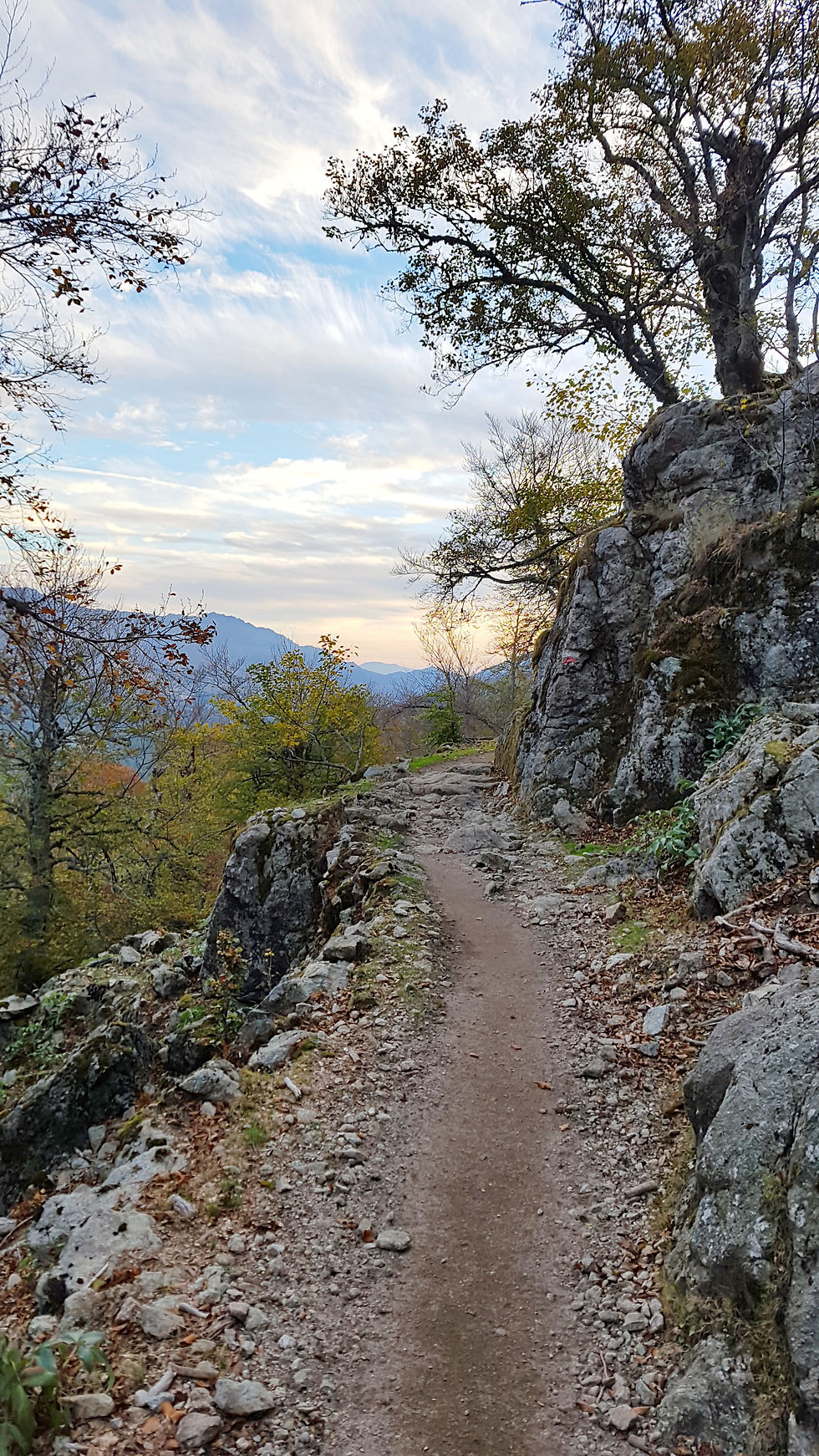
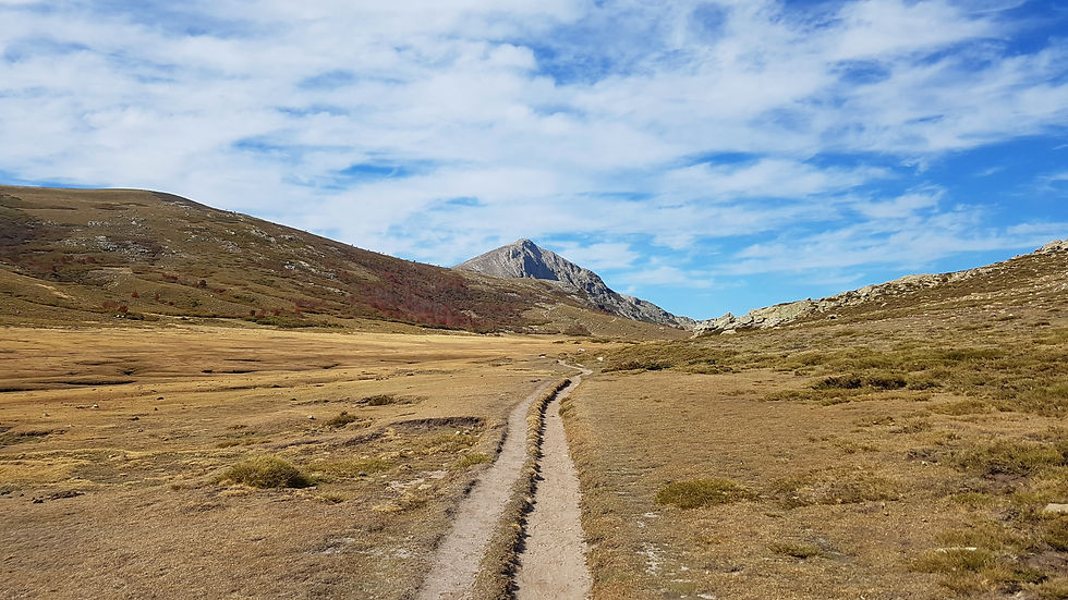
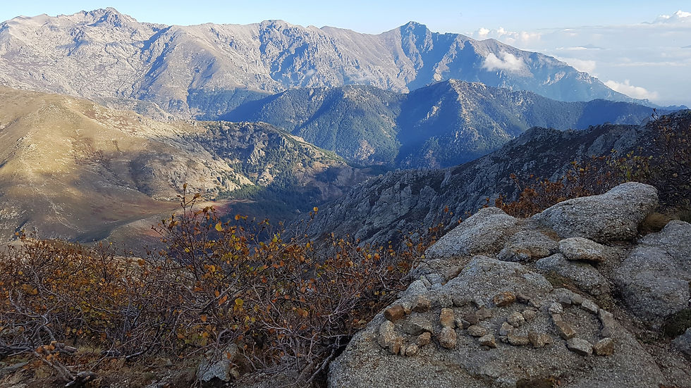
The GR20 traditionally starts in the small town of Calenzana (255m), approximately 12km south of Calvi Port, at the northern edge of the Corsican Mountain Range. The trail head is located in the middle of the village, a short walk from the local camp site, Gite Municipal Calenzana, where we stayed the night before. The route begins with a few flights of wooden stairs, followed by a steady ascent across sparely-vegetated slopes. There are amazing views back to Calenzana, as well as to the neighbouring village of Moncale, and to Calvi and Lumio on the coast. After about one hour, you reach a junction at 550m where you can choose the high-level route or low-level variant to Refuge d’Ortu. Feeling energetic, we continued to the left and along the high route.
The high route continues to a rocky gap beneath the peaks of Capu di u Ravalente at 625m, where you take one last look at Calenzana before it disappears from view. The trail is quite rugged but gradually sloped all the way to a pleasant grassy ledge at Arghioa - a nice spot for morning tea. From here, the trail zigzags up a steep, rocky slope through a young pine forest filled with wild pigs and cows. The path is well graded and well sign-posted all the way to Bocca a u Saltu (1250m). It takes about 4 hours to reach this point from Calenzana. The views are sensational and only a glimpse of what is to come.
GEO FACT
Although Corsica is referred to as “mountain in the sea” it is in fact two different mountains ranges which formed over different mountain building periods. The western mountain range comprises primarily intrusive rocks such as granite, while the eastern range includes metamorphic rocks such as schist, and sedimentary formations.
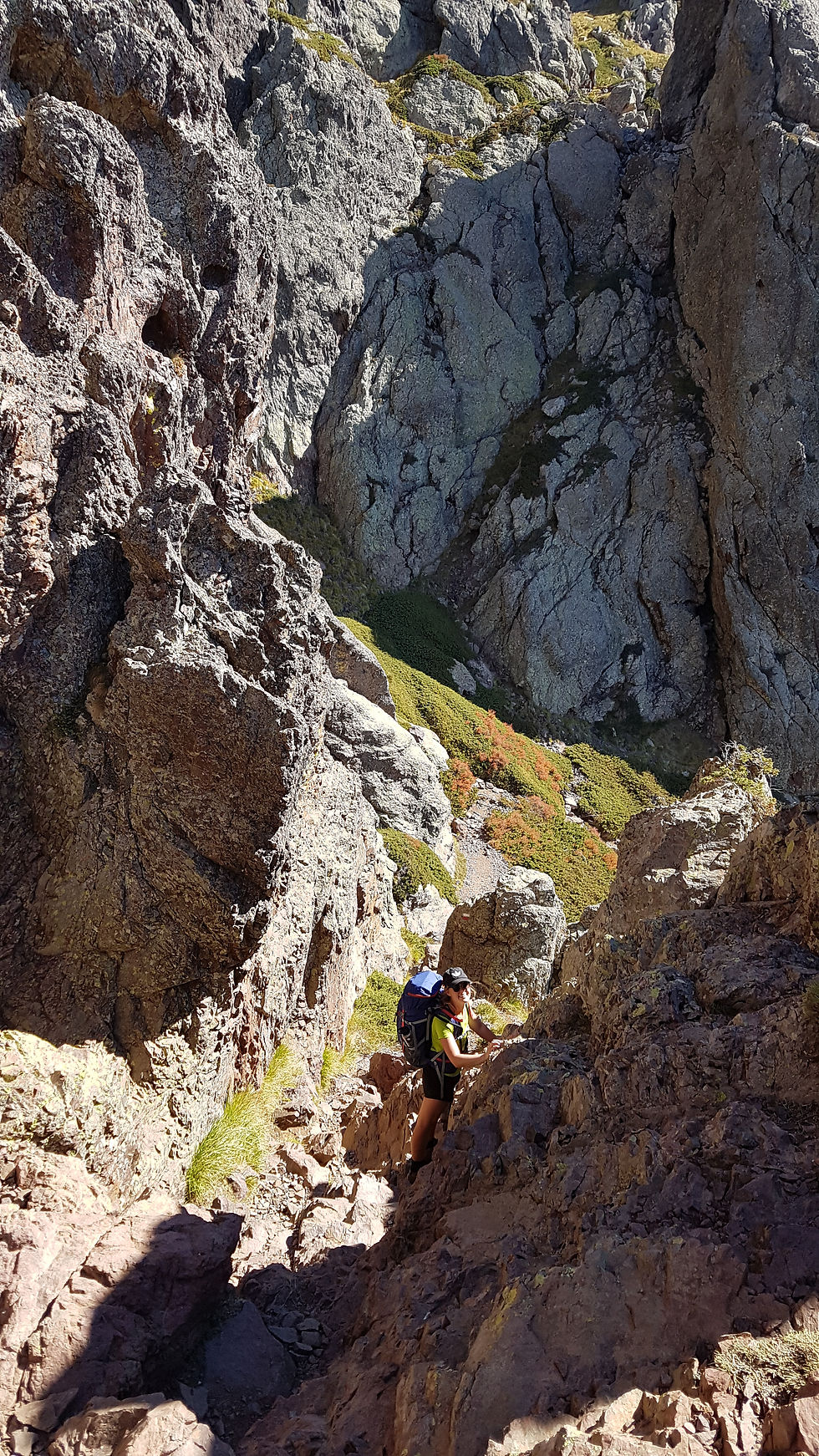
The trail briefly descends around the base of a cliff and into a tall pine forest. From here, you will experience your first GR20-style climb. The terrain becomes steep and rugged, and climbing and scrambling is required up rock faces and along narrow ledges. There are many holds but it can be difficult on the first day, especially with a full backpack on your back! Watch carefully for the trail markers as they always indicate the easiest route. It takes about 1.5 hours to each the second pass of the day, Bocca a u Bassiguella (1486m), depending how much caution is exercised during this section.


The route from Bocca a u Bassiguella to Refuge d’Ortu di u Piobbu is an easy end to the first day. It includes a brief climb through a pine forest before leveling out along the base of Crete de Fucu. The refuge is visible across the valley as well as distant mountains whose profiles will become familiar over the next few days. After another 1.5 hours, the trail rises across slopes of broken rock and around the head of the valley to Refuge d’Ortu di u Piobbu at 1570m.

The Refuge
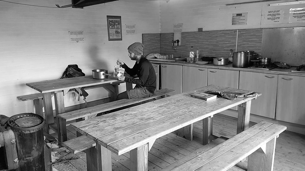
Refuge d’Ortu di u Piobbu wins first place for location. It is positioned on a steep slope, surrounded by mountains, and overlooking a deep, forested valley. In late September, this refuge is not operating but it is still open and gas cookers are available for use. There is also an outdoor toilet block (a luxury during this season), and a water source signposted about 200m beyond the refuge. Our first night here was the most memorable; the sunset was incredible from our tiny, remote camp site.

Stage Two – Refuge d’Ortu di u Piobbu to Refuge de Carozzu
Distance: 8km
Accent: 750m
Descent: 1050m
Time: 7 hours
Stage Two also offers a high-level route and low-level variant. The high-level route is a tough day, especially following the exertions of Stage One, but trust me, it is worth it for the magnificent view from Bocca Piccaia (1950m).
After breakfast we continued south, passing the creek, and following the trail into a boulder-filled, birch forest. The colours of the trees looked incredible, reflecting every autumn shade. The terrain is rugged with some sections of climbing around a shoulder (1627m) before descending into a valley. The birch trees become dwarfed by large pine trees, and by the giant rock slabs that line the valley walls. This is a good location to spot Mouflon on the rocky ledges.

GEO FACT
The bedrock geology of Corsica is essentially a massive granite intrusion, which can be seen in this valley. During a first period of mountain building, this intrusion was pushed into the Earth’s crust under immense pressure and temperature, so that the rock was exposed in a molten (liquid) state. As it cooled over a long period of time, coarse crystals formed, primarily quartz, feldspar and shiny micas, which you will see along the GR20 trail.
The route climbs steeply along the edge of the valley between trees and bare rock walls. As you climb higher, the trees begin to thin out and there are views back toward the coastline. The route zigzags across open rock slopes with some scrambling involved to reach the gap at the head of the valley, Bocca Piccaia (1950m). It takes about 2.5 hours to reach the pass from Refuge d’Ortu di u Piobbu.
The peaks of Punta Piccaia and Capu Ladroncellu flank the gap, but your attention will be drawn to Ladroncellu Valley, which is surrounded by incredible mountains, and filled with pinnacles and towers of rock. Layers of whispy clouds made the scenery look like something out of a sci-fi movie. This is a great place to stop for lunch.


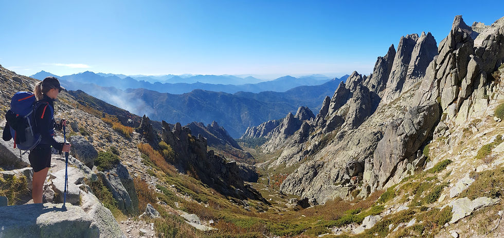
The next section of the trail is intense. Although the route traverses two mountains, Capu Ladroncellu and Punta Ghialla, the terrain is undulating and at least 100m of additional ascent and descent is required. You will find yourself grappling with rock, taking on steep scree slopes and faced with awkward near-vertical climbs. It is absolutely exhausting and takes much longer than you’d anticipate. Our guide book estimates 1.75 hours from Bocca Piccaia to Bocca Carozzu (1865m), but 3 to 4 hours is more realistic. Take plenty of breaks, re-fuel with food and water, and keep an eye out for those red and white markers.


From Bocca Carozzu, the route descends to Refuge de Carozzu. The trail is very steep with many tight switchbacks and sections of boulders and loose gravel. Eventually the trail swings right around a bend in the valley and the refuge becomes visible. The descent is gentler through pine trees and requires one short stream crossing before arriving at Refuge de Carozzu (1270m).
The Refuge
Refuge de Carozzu is precariously situated on the only section of flat land in the valley. It features a small hut with a large wooden deck, a separate toilet and shower block, numerous camping spots and most impressively, a man-made helicopter landing pad! The refuge was not operating but the hut was unlocked with gas cookers available for off-season use. Water is available just north of the hut among the camp sites. The location of this refuge means the sun sets behind the mountains early, and the temperature drops fast - so be prepared for a cool evening.
Stage Three – Refuge de Carozzu to Ascu Stagnu
Distance: 6km
Accent: 860m
Descent: 710m
Time: 6 hours
Stage three is a tough day with no easier alternatives. From Refuge de Carozzu, follow the signs toward Ascu, making sure you remain on the GR20 trail – it is easy to get lost here! The rugged descent takes you to Ruisseau de Spasimata (1220m), where an impressive metal suspension bridge spans the river. The pools below the bridge are a popular swimming spot for locals and hikers in hot weather.
From the bridge, you will find yourself at the base of the infamous Spasimata Slabs – a monstrous rock staircase high above the gorge. Although some cables have been fixed to the rock, most of the slabs are unprotected. Do not attempt to cross the slabs in wet or icy conditions, even a light frost will make them treacherous.


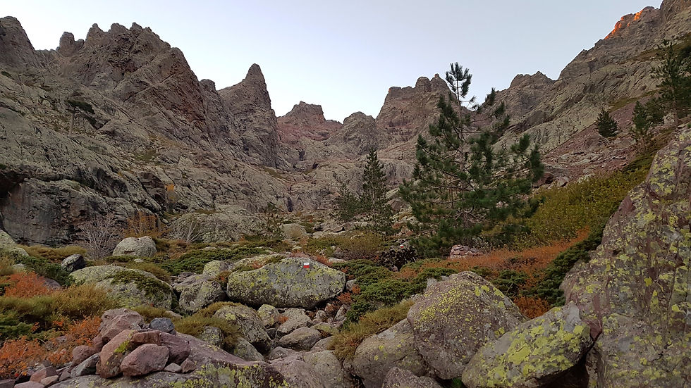
The route takes you passed a waterfall before veering to the right and into a wooded side valley. The terrain becomes steep and stony underfoot as you climb through birch trees to Lac de la Muvrella (1860m). The final climb zigzags up a scree-filled gully to the narrow, rocky gap of Bocca Muvrella at 1980m. It will take about 4 hours to reach the pass from Refuge de Carozzu. Stop for lunch here and take in the new scenery.
GEO FACT
You might notice red crystals in the rock outcrops in this area. These crystals are called garnets and are commonly found in the metamorphic rocks known as schist. Schist is formed when granite is exposed to extreme temperature and pressure, causing old and new crystals to grow and align. These rocks formed in a second stage of mountain building and dominate the eastern side of the island.

Continue to the right along an undulating, rocky ledge to another narrow gap called Bocca a i Stagni (2003m). The trail becomes steep and stony as it descends back and forth across the valley. The buildings of Ascu Stagnu are visible but they do not seem to get any closer. Nearing the bottom of the valley, the buildings disappear from sight and the trail moves to the right along a bouldery slope covered in pine trees. Look out for marmots, eagles and trees that look like they inspired the Lion King. Once you arrive at a wide, gravel road, after approximately 2 hours of descent, follow the sign posts and markers to Ascu Stagnu (1422m).
The Refuge
Ascu Stagnu is a ski station that includes a few buildings at the base of a chairlift. This point is often an escape route for hikers who have been struggling along the GR20 this far. If you are continuing on, there are a couple of accommodation options including a hotel and refuge. The refuge is spacious with great facilities and many camping spots around the building. There are gas cookers inside, as well as hot showers, electricity and phone service – talk about luxurious. We were also lucky enough to arrive just as the food store was closing for the season, so were able to stock up on an assortment of fruits, canned ravioli and dry pasta.
\Stage Four – Ascu Stagnu to Refuge de Tighjettu
Distance: 9km
Ascent: 1250m
Descent: 1230m
Time: 8 hours
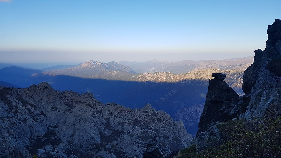
Unfortunately, things don’t get any easier on day four. The elevation change today is huge as you get right up close to Monte Cinto (2706m) – the highest point in the Corsica Range. This trail was originally a variant from the traditional GR20 but following an incident in June 2015 on the Cirque de la Solitude, it was established as the main route. Since our trip, the markers have been repainted with traditional GR20 stripes.
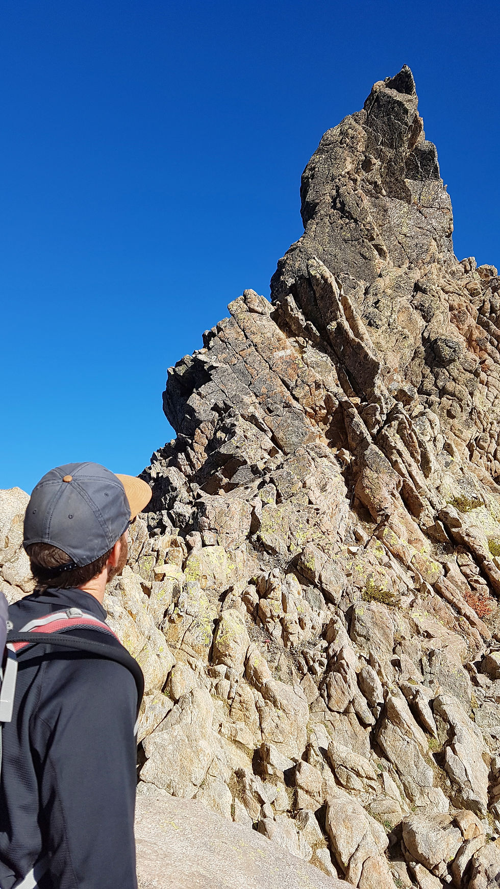
We started the day early, leaving the refuge at 6.30am in the dark. We watched the sun rise through pine trees before crossing the wooden footbridge at Ruisseau de Tighjettu (1488m). The ascent becomes more difficult up a rocky slope, with chains to guide you over some sections. Watch carefully for markers as they indicate crucial turns and show the best way through awkward gullies. The steep rocky slopes soon turn to wide scree scopes and scrambling is necessary along the side of the valley. Here, you’ll find yourself surrounded by incredible rock towers, including the ominous overhang of La Tour Penchee. The vastness of the scenery here is other-worldly and something no camera can truly capture.

GEO FACT
Did you know that over two-thirds of the island of Corsica is covered by mountains? Making it the most mountainous island in the Mediterranean Sea.
The trail remains rough and gravelly until you reach a stony hollow around 2150m. From here, you encounter a couple of scree slopes before taking on a near-vertical climb to Point des Eboulis. This was the only time during the GR20 when I was genuinely scared. The trail is quite active and barely traceable except for a few paint markers, as most surfaces are covered in broken rock. The holds and footings are narrow and can be awkward with a large backpack. But after four hours of climbing, scrambling and (probable) crying, the panoramic views from Point des Eboulis (2607m) make it all worthwhile. Look out for Calvi Castle and Calenzana along the coastline, and Ascu Stagnu appearing as a tiny dot in the distance.
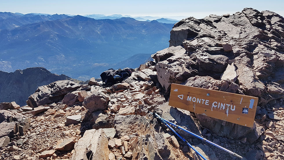
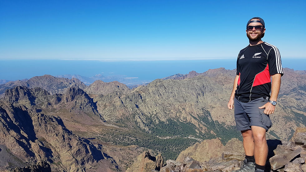
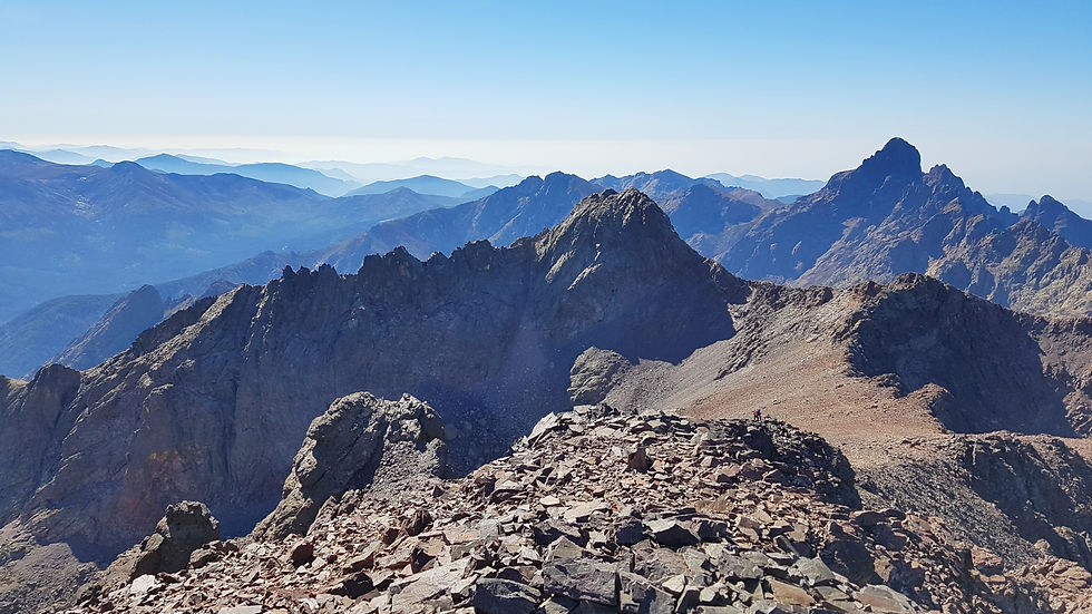

If you're up for it, you can continue along a variant trail to the summit of Monte Cinto (2706m). The guide book estimates a 1.5-hour return trip, but it is more like 3 hours. You can leave your backpack at Point des Eboulis, but make sure you take plenty of water and any essential items with you. The trail is rocky and undulating all the way to summit, but worth it for the extensive views of both west and eastern coastlines.
GEO FACT
How did these peaks become so high? The landscape you see here is the result of mountain-building caused by the collision of the African and Euro-Asian tectonic plates. This process pushed rock masses high into the air, and as a result, Corsica is home to 20 mountains that are greater than 2,000 metres above sea level.
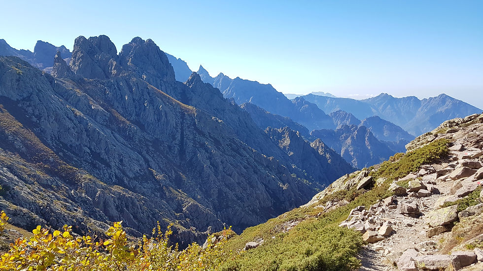
To continue along the GR20, follow the signs toward Bocca Crucetta and Tighjettu. The trail gradually descends across broken rock slopes, around Lac du Cinto, and rises slightly to the gap Bocca Crucetta (2452m). A well-worn path zigzags down a wide scree slope with an amazing view through a valley dominated by rocky buttresses and the summit of Paglia Orba. The rest of stage four alternates between gravelly slopes that wind through the valley, and steep descents down bare rock and boulders. It takes about three hours to reach the junction for Refuge de Tighjettu, followed by a brief climb to 1683m.

The Refuge
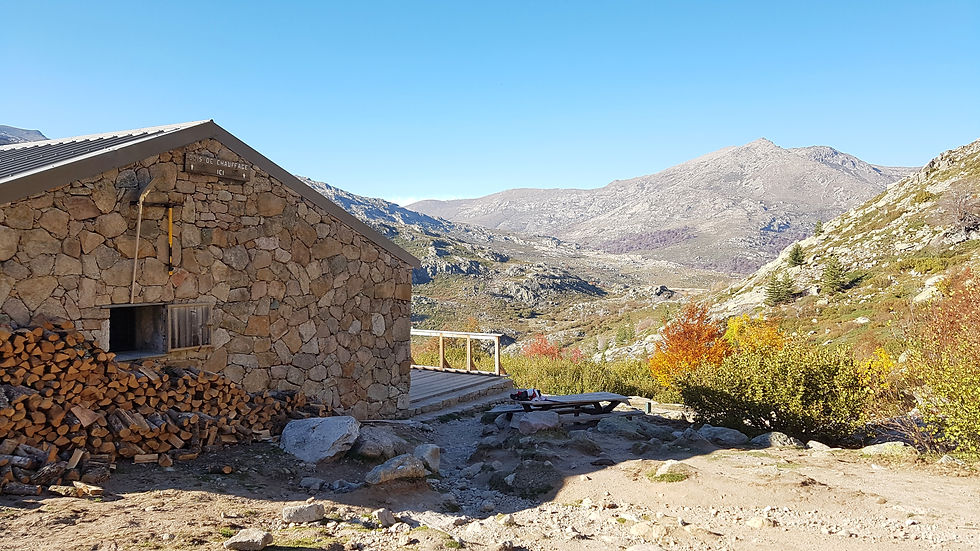
Refuge de Tighjettu is a beautiful wooden cabin positioned perfectly in a sparse, glacial valley. There are many camping spots around the building, and a toilet and water source about 100m down slope. The hut is spacious with gas cookers and electricity. It was at Refuge de Tighjettu that we meet our first fellow GR20 hiker, a French man named Philip, who we shared dinner with before watching a phenomenal sunset.

Stage Five – Refuge de Tighjettu to Hotel Castel di Vergio
Distance: 15km
Ascent: 850m
Descent: 870m
Time: 7 hours
Following a tough first four days on the GR20, stage five is much easier and includes some of my favourite scenery. The rugged, mountainous terrain is replaced with more gentle features, including meadows, wide valleys, rock pools and alpine lakes.
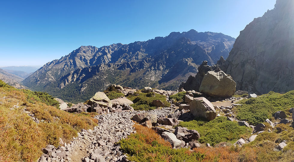
From Refuge de Tighjettu, continue for an hour down the valley to the next refuge, Auberge U Vallone, at 1440m. The route then winds through a dense pine forest filled with pine cones, and around a rock shoulder and into the next valley. Out of the trees and exposed to the sun, the trail becomes steep and gravelly as it climbs uphill and suddenly reaches a slope of bare rock. As you encounter a few stream crossings, and admire the mountain flora, look out for mouflon grazing on the surrounding rock slopes. Near the head of the valley you cross an area of broken rock and climb steeply to Bocca di Foggiale (1962m). The trail cuts across a scree slope to a cairn at 2050m, the highest point of the day.


Below you will see Refuge de Ciottulu di I Mori (1991m), and the impressive Paglia Orba (2525m) towering above it. This is a popular spot for rock climbers and hikers, and the trail to Paglia Orba is often climbed as a variant along the GR20. A gradual, gravelly slope takes you past camp sites and down to the Refuge de Ciottulu di I Mori for lunch. You should reach this spot about 3.25 hours after leaving Auberge U Vallone.

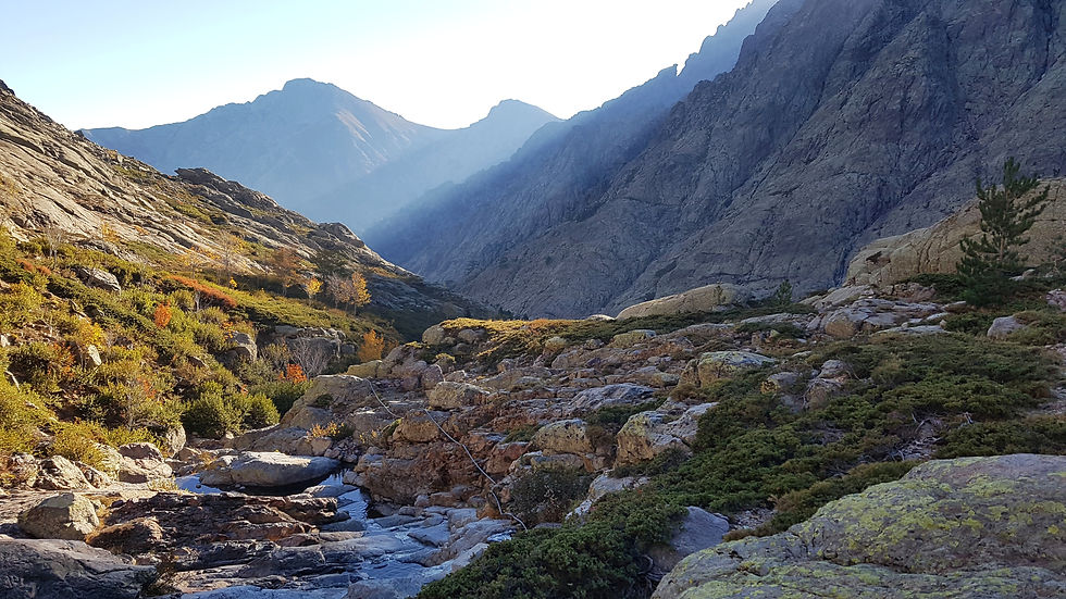
Before dropping down into the valley, the trail follows the ridge line to a rounded summit at 1954m, where the view westward shows off the coastline and Golfe de Porto. The trail becomes more rugged as it descends into the valley and along the edge of Golo – the longest river in Corsica. The scenery down the valley is suburb – the walls lined with steep, towering peaks, and the valley bottom filled with autumn-coloured vegetation, smooth rock formations, and waterfalls plunging into crystal-clear pools (stopping for a quick dip is a must!). As the valley veers to the left, look out for markers that take you across the river.


GEO FACT
Following these periods of mountain building, many processes have contributed to shaping the landscape of Corsica. The most dominant geological processes to shape the mountains in recent times is glaciation. During the Ice Age around 10,000 years ago, many glaciers would have advanced through the region, carving out the mountains as they moved. Evidence of this is shown by large V-shaped valleys such as this one, as well as moraine deposits and traces of ancient frozen terrain, left behind when the large ice masses retreated.
From here, the valley steepens slightly and the trail crosses rock slabs and bouldery slopes. There are many huge pines trees throughout the valley – some of them are over 300 years old and stand over 30m tall! A second footbridge eventually leads back to the west side of the valley, and a quick climb up some rock slabs takes you to Bergerie de Radule (1370m). During our hike, this footbridge had been wiped out by trees and we had to scramble down and out of the valley instead. It should take about 1.5 hours to reach this point from Refuge de Ciottulu di I Mori.

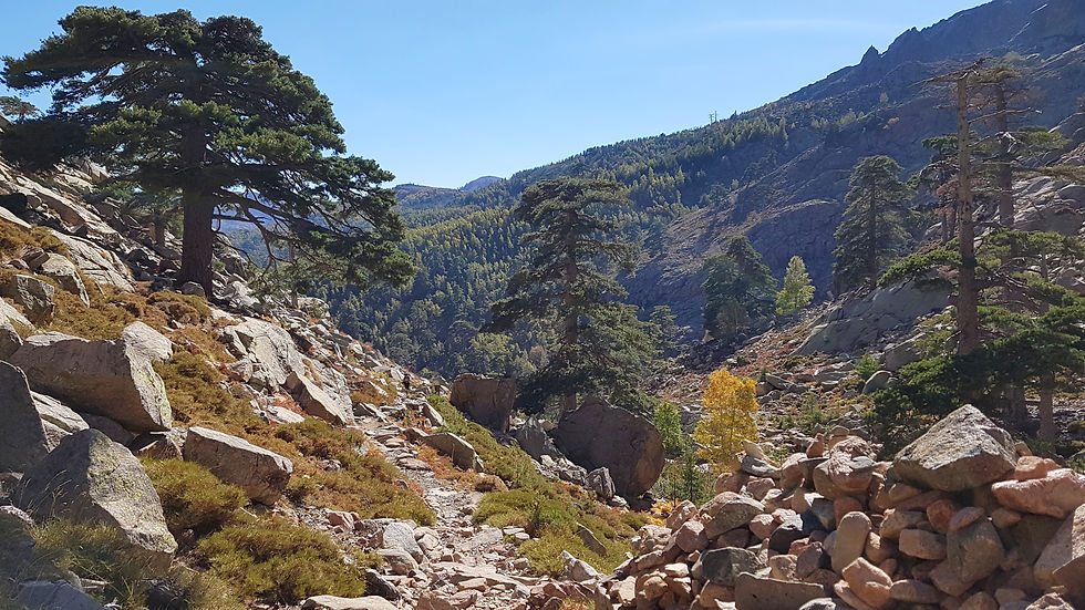
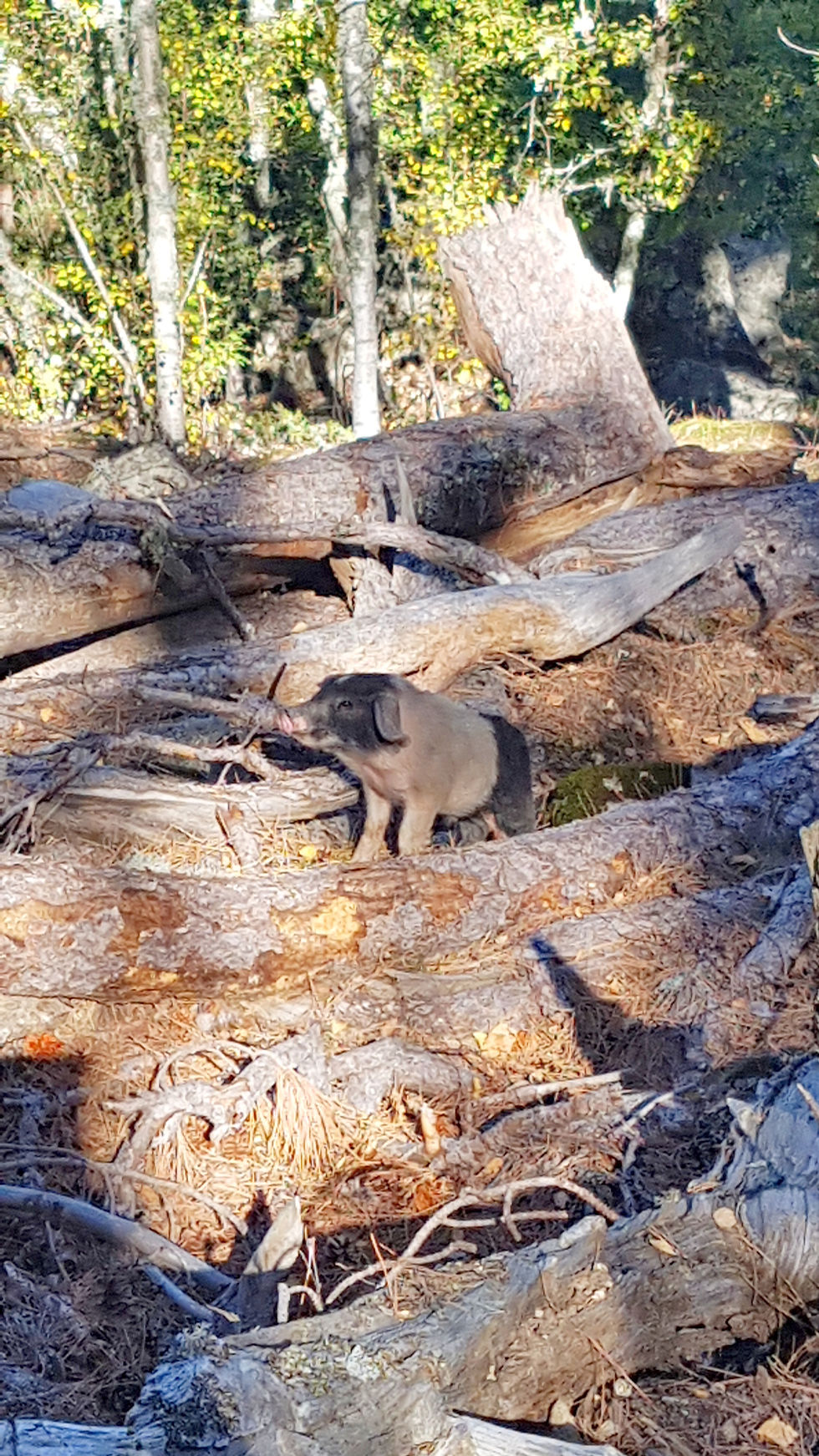
The final section of the day is an easy, one hour walk through a birch forest - look out for wild pigs! The trail eventually reaches a main road (D184) where you turn left and quickly arrive at Hotel Castel de Vergio at 1404m.
The Refuge
Hotel Castel di Vergio is a large, modern building situated at the base of a ski tow along a main road (so it wins no awards for most picturesque setting). It provides a mixture of hotel rooms, dormitories and campsites, with a seasonal food store, restaurant and bar. The food store was open when we arrived, so we excitedly filled up on fruit, bread and canned goods. The campsite has an outdoor kitchen and bathrooms and is fenced to keep wild pigs out. However, foxes and small pigs find a way around it, so remember to store food at height and away from your tent. This was also the only accommodation we had to pay for – about €6 per night each.

Stage Six – Hotel Castel di Vergio to Refuge de Manganu
Distance: 17km
Accent: 670m
Descent: 475m
Time: 6 hours
You’ll be relieved to learn that Stage Six is another easy day. The scenery is not as dramatic as the start of the GR20, but instead, pleasant and serene. As we were becoming bored of our daily protein shakes, we treated ourselves to bread and jam for breakfast, and thought about how the little things in our usual day to day lives can become extraordinary when you’re in the middle of the mountains.
A short walk down the D184 takes you to sign posts for Lac du Ninu and Refuge de Manganu. The first section of the trail includes a flat, well-engineered path through a pine forest. There are views between the trees looking back to Paglia Orba and Monte Cinto. After an hour or so, the route takes a sharp right turn and zigzags up a gravelly slope to Bocca San Pecru (1452m).

Continue left along an old mule trail and across the slopes of the mountain, u Tritore. The trail is gradual and winding through pine trees most of the way. Look out for sharp turns as you climb - it is easy to continue along the wrong path (as we did so a couple of times). Once out of the trees, the trail follows a mountain crest, passing a few gaps, each with wonderful views to the south. Follow the gravelly slopes of Capu a u Tozza to reach the broad, grassy gap of Bocca a Reta (1883m).

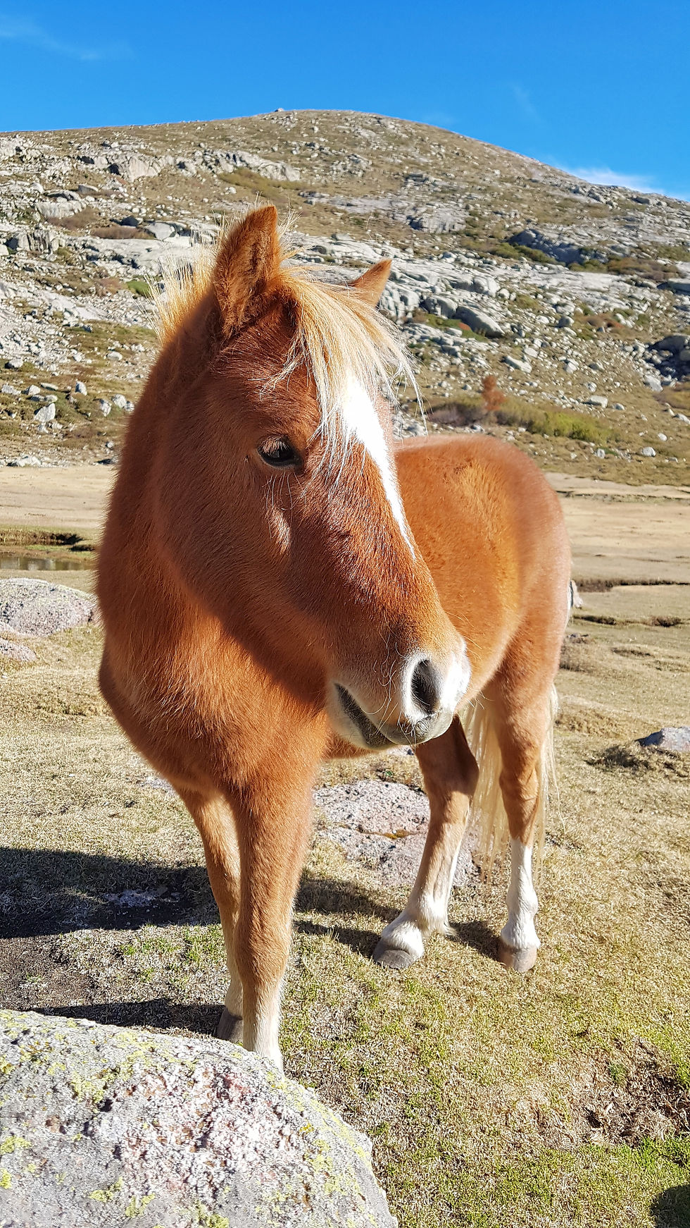
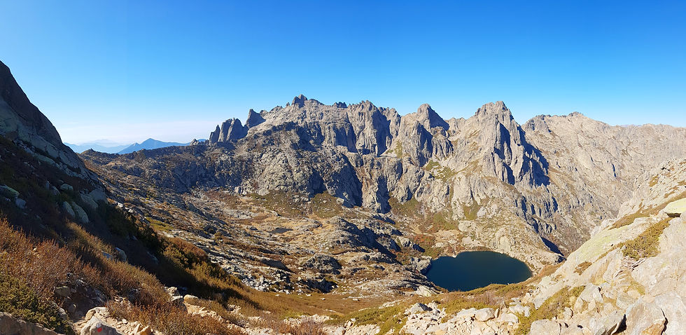
A short descent takes you down to the magnificent Lac du Ninu (1743m). This bright blue lake is nestled between large mountain peaks in a lush, grassy meadow filled with large boulders and grazing wild horses and cattle. The lake is 11m deep and feeds the Tavignanu, one of Corsica’s finest rivers. On a calm day the scenery is absolutely breath-taking so be sure to spend some time here. We spent about two hours sun-bathing in the grass and saving our lunch from the greedy horses.

GEO FACT
Lac du Ninu, as well as many other lakes in the area, is a glacial lake that formed as a result of past glacial processes. As glaciers recede, they leave behind holes and spaces that fill with melt water over time. Furthermore, the scouring action of the glaciers pulverizes minerals in the rock, which becomes sediment at the bottom of the lake. These suspended minerals support a large population of algae that produce those breathtaking bright blue and green colours you see here.
The markers take you along the northern edge of the lake, though it is possible to take the southern route too which passes a water source. Take a moment to look back at Capu a u Tozzu reflecting in the water to the north. The trail runs level through a broad valley, offering a quick detour to Bergerie de I’lnzecche for snacks in the summer months. After a stream crossing, the route descends down a jagged, boulder-strewn slope covered with beech trees and native scrub. As the trail veers to the right, Bergerie de Vaccaghja (1600m) comes into sight and so does Refuge de Manganu. It takes about two hours to reach this spot from Lac du Ninu.


The last section of the day includes strolling across a gradually sloped, grassy meadow, before one final rocky ascent to the refuge. After crossing a stream over a wooden footbridge, you arrive at Refuge de Manganu (1601m), 45 minutes from the previous refuge.
The Refuge
Manganu was one of our favourite refuges. The hut is small and simplistic with gas cooking facilities provided, and plenty of campsites on the surrounding slope. There is a water source not too far from the hut, as well as a nearby river with many pools for swimming at the end of a long day. On this night the hut was surprisingly full, with hikers from France, England and Argentina. There were more people than we had encountered along the GR20 so far! We had a wonderful night and learnt about French constellations before heading to bed.
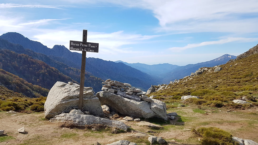
Stage Seven – Refuge de Manganu to Refuge de Petra Piana
Distance: 10km
Accent: 980km
Descent: 740m
Time: 7 hours
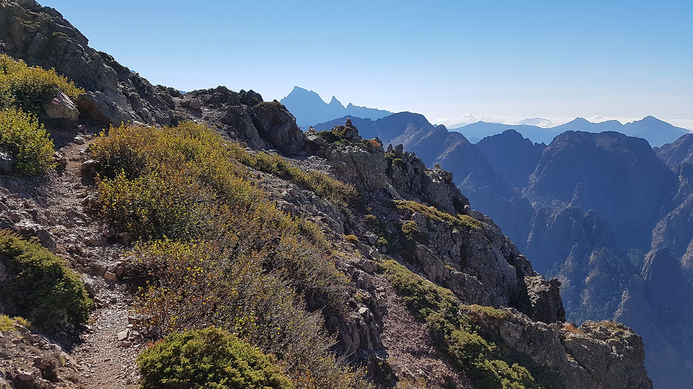
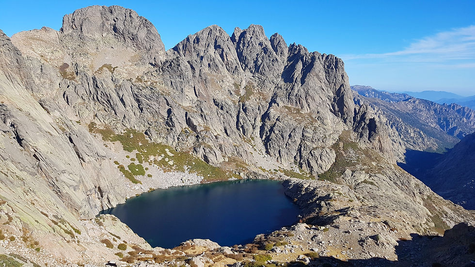
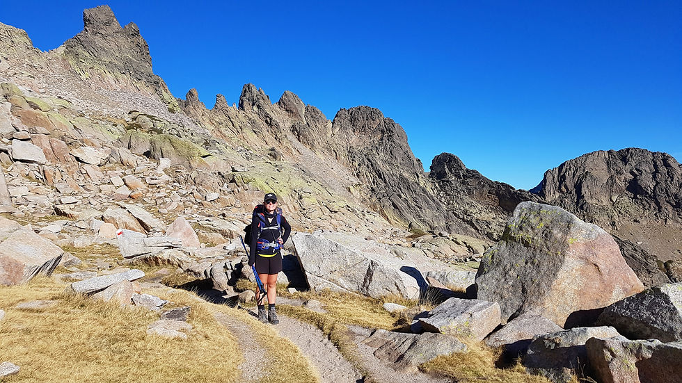
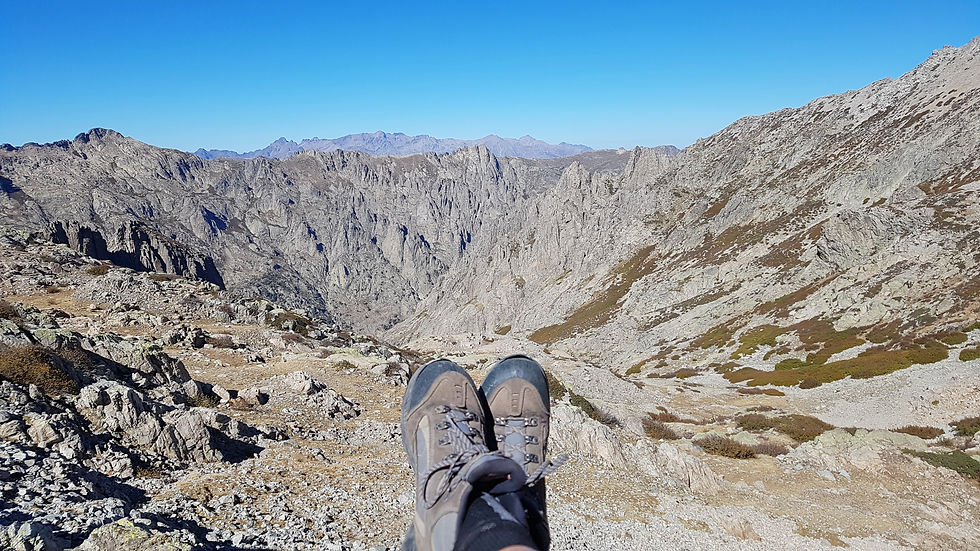
After a couple of easy stages comes another tough day along the GR20. We started the day early again, anticipating that it would take us longer than the estimated time. After crossing back across the footbridge, we turned right and started the journey to the head of a stepped valley. The terrain is rugged with some steep and gravelly sections - but nothing that we aren’t used to by now. The valley is lined with flowing waterfalls, and you occasionally find yourself on level, grassy areas for a rest. It takes about 2.5 hours to reach the narrow gap of Bocca a e Porte (2225m), shadowed by the unusually-shaped peaks of Capu a i Sorbi and Punta a e Porte.


From this point, your attention will be fixated on the two deep blue lakes far below the rugged peaks; their location making them resemble craters! We rested at this spot for a while to take in the scenery and warm up in the sun. The next section is not very far but takes about 45 minutes as it is very technical. The trail is lost completely as you traverse around the steep, scree-covered slopes of Punta a e Portu. This route requires grappling with rock slabs, boulders and awkward steep gullies to a rocky notch at 2090m.
GEO FACT
What forms these strange towers of rock? Another recent, and on-going, erosional process induced by the weather. Rain, snow and wind have carved out, weathered, and broken down the structure of the rock to shape these peaks and pinnacles, and will continue to do so in the future.
The GR20 then cuts across to the southern side of the ridge. The trail is technical and undulating, with occasional views of Lac du Capitellu (the upper lake) and Lac du Melo (the lower lake). The route swings to the left, and you follow the signs to Bocca a Soliga (2052m), approximately 45 minutes from the previous gap. This is a great spot for lunch before the last climb of the day.
The final climb ascends the rugged slopes of Punta Muzzella. The gradients are gradual at first but become very steep very quickly, requiring scrambling at times. You pass a lovely grassy pozzine perched above Lac du Renosu before finishing the climb at Bocca Muzzella, or more commonly the Col de la Haute Route (2206m). It takes about 2 hours to reach this point from the last pass.
The descent to Refuge de Petra Piana (1842m) is rugged but gradual as it traverses the slopes of Stazzanelli. The trail zigzags a little before arriving at the refuge one hour later.


The Refuge
Refuge de Petra Piana is a tiny wooden hut situated at the head of a glacial valley. It comprises a kitchen, about 12 bunk beds and a balcony positioned perfectly for sunrise views. Camp sites are dotted around the area between undulating slopes and boulders. Unsurprisingly, the refuge was closed for the off-season, but gas cookers were still provided, and there was a water source not far from the front door. We found an old petonque set in the hut and played until the sun set.
Stage Eight – Refuge de Petra Piana to Refuge de l’Onda
Distance: 8km
Accent: 390km
Descent: 800m
Time: 4.5 hours
The shortest day of the GR20! With plenty of time on our hands, we hung around to watch the sun rise completely along the eastern coastline.

Like the early stages of the GR20, stage eight has two options - a high-level or a low-level route. This time the traditional route is low-level route, which takes you down into the valley, passing a popular bergerie, and back up a perpendicular valley to Refuge de l’Onda. This time, we chose to take the high-level variant, which follows a mountain ridge to the refuge, with less elevation change and more rewarding views.
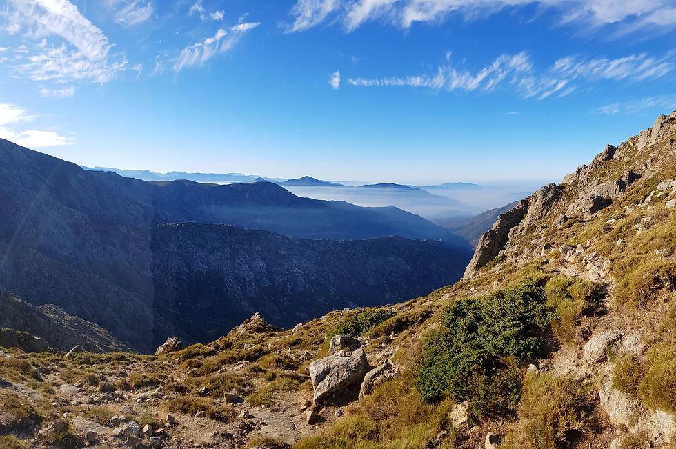
The high-level variant starts along the GR20 route, then turns right at a junction just beyond the refuge. The trail follows non-traditional yellow markers, beginning with an awkward, gravelly scramble to a gap above the refuge. From here, the trail becomes easier with some rocky sections alternating with grassy slopes. The trail skirts the summit of Punta Murance at 1921m, crosses the rounded summit of Serra Bianca at 1970m, and climbs a narrow ridge of broken rock to Punta di I Pinzi Corbini at 2021m. The third peak provides panoramic views showing off both coastlines and the city Ajaccio (our final destination in Corsica).

The route continues along the ridge of broken rock and steeply descends to Bocca a Meta (1890m). This section is quite technical and requires a lot of climbing and awkward balancing – so take care! From the pass, the trail climbs steeply up a series of rock faces to a rocky notch (1991m) close to the summit of Serra di Tenda. From here you can see Monte d’Oru – the second largest peak in Corsica, as well as Refuge de l’Onda and the next stage of the GR20 trail below. We stopped for lunch and enjoyed the views in the sun. It takes about 2.5 hours to reach this spot from Refuge de Petra Piana.

GEO FACT
Another recent and current day process shaping the landscape include mass movements such as landslides, debris flows and rock falls; triggered by factors such as climatic conditions, structural discontinues in rocks, tectonics or human activities. There are many textbook examples throughout the mountain range, such as these broken rock-covered slopes which remind us that this landscape is still active and forever changing.
The high slopes are grassy and follow the contours for the long time before dropping down steeply to Bocca d’Oreccia (1427m) – home to many cows at the time of our arrival. Follow the narrow path up and over a small hill to Refuge de l’Onda (1431m).
The Refuge
Refuge de l’Onda is a simple hut with a bunk room and basic kitchen facilities (gas cookers provided). The campsite is located at the base of the slope, about a 10-minute walk and 30m descent from the refuge. The campsite includes a large grassy area, fenced off from cattle and pigs. It has a water source and a toilet and shower block that was closed for the off-season. As we finished early this day, we enjoyed relaxing in the sun, taking in our last mountain views, and recharging for the final stage of the GR20.
Stage Nine – Refuge de l’Onda to Vizzavona
Distance: 11km
Accent: 670km
Descent: 1180m
Time: 6 hours
Getting up before sunrise on the ninth day seemed easier than ever! We knew we would miss the mountains and the GR20, but after nine days of dehydrated meals and protein shakes, we were dreaming about dinner in Ajaccio that night. We packed up all our damp camping gear one last time, ditched our broken air mattresses, and with the lightest packs so far, started our journey to Vizzavona.


The GR20 trail climbs back up past the refuge and turns left along a stony ridge. On our way to the refuge, we spotted two salamanders on the trail - we had heard so much about them and were excited to see them up close. The trail steepens up a ridge with sections of gravel and bare rock all the way to the main crest near Punta Muratello (2100m). It takes about 2.5 hours to reach the crest from Refuge de l’Onda. Ahead of you are amazing views of Monte d’Oru and Punta Migliarello, and behind you, a distant reminder of how far you have come.
From here, there is a high route variant that takes you to Vizzavona via the summit of Monte d’Oru (2389m). This trail adds about 2 hours to the day, including an additional 2km and 300m ascent. We had planned to take this route, however, the ominous, black clouds moving in from the south had us change our minds.
Continuing along the traditional GR20 trail involves a rough, gravelly, zigzagging descent with many boulders and sections of scree. In the past, I had struggled a lot with these descents, but by this stage of the GR20, I was a downhill expert with new-found balance and speed. After an hour, the trail flattens out and the valley fills with small waterfalls, rock pools and autumn trees. The trail continues in this way until you reach a dense forest and the La Cascade Bar at 1092m. The total descent should take about 2.5 hours.

This area is a popular destination for day hikers visiting the waterfalls. At this time of the year, there was much less water, but the scenery was still beautiful and worth stopping for. To continue to Vizzavona, cross the footbridge next to the bar. The trail broadens through the forest and very gradually descends all the way into town. The final 4km is relaxing and a complete contrast to the 96km before. As the forest trail ends, you arrive at a paved road and turn left into the Vizzavona township.
GEO FACT
One final process shaping this landscape is human activity. This process is severe in some parts of the world, though the Corsican Mountains are lucky in that they remain mostly untouched. As we explore this beautiful island we must be aware of the impact humans can have, and do our best to preserve what nature has created here. Stay on the dirt trails, watch where you stand, and leave nothing but footprints behind.


Vizzavona is a small village with some accommodation, restaurants and a food store. When we arrived in Vizzavona everything was closed, and it appeared as a ghost town – perhaps due to the season. We found the train station and caught the 2pm train, arriving in Ajaccio by 3pm for much deserved fresh food and warm showers. We spent the next couple of days relaxing in Ajaccio, enjoying a different side of Corsica, and reminiscing about our crazy mountain adventure.
Planning for the GR20
Terrain
The terrain along the GR20 is rugged, undulating and technical. The trail is primarily a narrow, gravelly path but also includes sections of bare rock and scree slopes. Slopes are generally steep during both ascents and descents and require careful footing and occasional route planning.
The Route
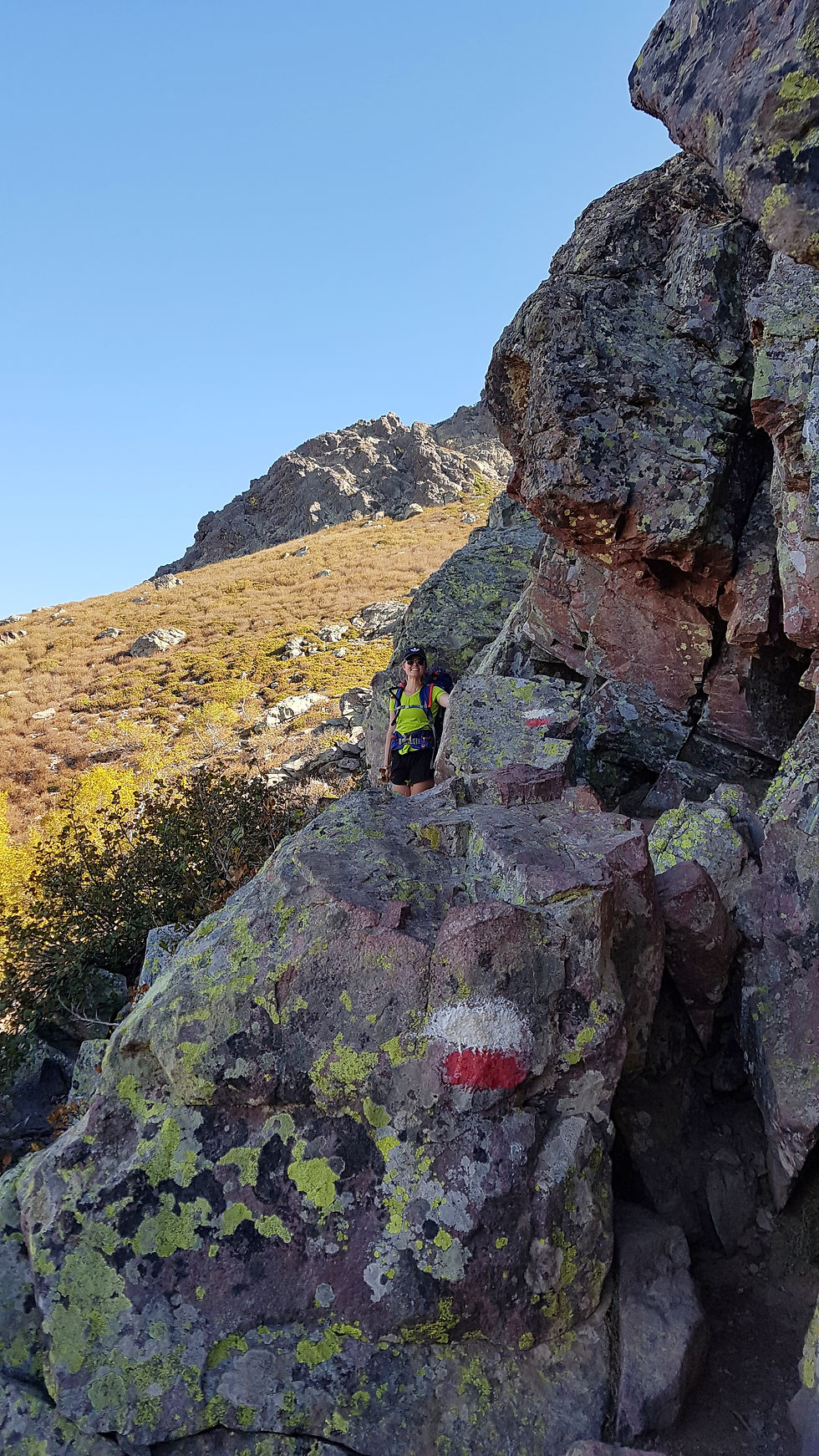
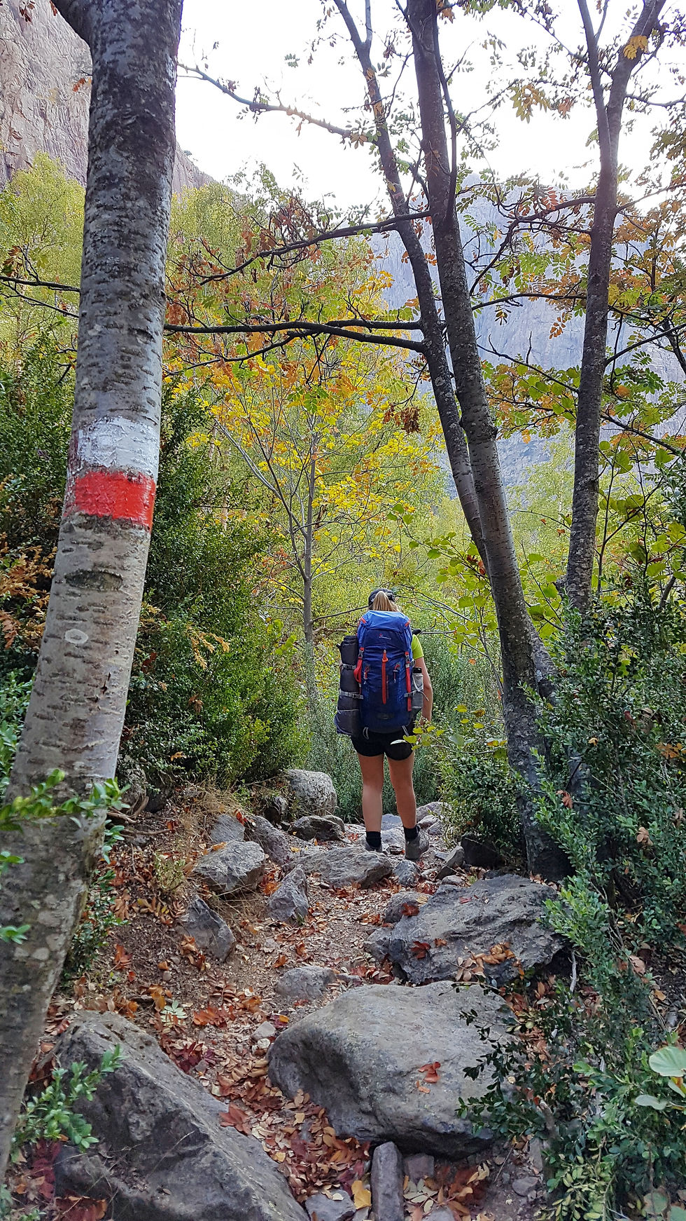
The GR20 is reasonably well marked throughout its length. Markings appear as white and red stripes painted on rock faces, boulders and trees, and there are also occasional signposts, arrow markers and rock piles. Feeder trails are marked by a single-coloured stripe.

Though the trail is marked, it is essential to carry a GPS, map and/or a guidebook for situations where the route is unclear or obscured by snow or gravel. We purchased a guidebook, The GR20 Corsica – The High-Level Route by Paddy Dillon, for about €40. The book provides day-to-day descriptions of the trail, including maps and photographs. We found that on few occasions the estimated times were inaccurate, but overall, the book was very informative and helped us through much of the GR20.
If you prefer to purchase maps, I recommend the IGN maps which are divided into northern and southern regions:
GPS data files are also available for download on this website. We used the app MapsMe as a backup and downloaded all Corsica data on to multiple devices.
Timing
The full length of the GR20 trail, from Calenzana to Conca, takes about 15 days to complete. As we had limited time, we chose to take on the northern half of the trail, from Calenzana to Vizzavona, in nine days. This section of the trail is known for being tougher with more dramatic, mountainous landscapes.
Our itinerary is summarised below:
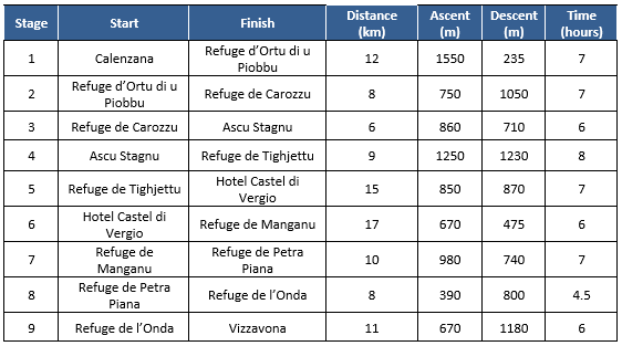
The distance and times for this table are our personal estimations. For more information about refuges and timing, I recommend checking out this website.
Season
Peak season for the GR20 is from late June to early September, when the refuges are fully operating, and the weather is most predictable. In the off-season, the refuges are open but unguarded, and you must carry all your food. Between November and May the mountains are snow covered, and the trail becomes quite dangerous. It is possible to complete the GR20 in Winter but is only advised for experienced cross country skiers with a high mountain guide.
We completed the GR20 in mid to late-September, which is the change over time between peak and off-peak season. This meant that the refuges were unguarded and we had to carry our own supplies. The trail at this time was not busy – we only bumped into 10 or so other hikers the entire trip! And the scenery changed from green to autumn browns before our eyes. The weather was still warm, but the nights were cooler and the chance of storms were high (we were lucky to have 9 days of sunshine).
Refuges
Spaced out along the GR20 route are refuges or “gites” in French. During peak season, they have full cooking and sleeping facilities, and often sell food and supplies. During the off-peak season they are still open but only to provide gas cookers and water to campers. The refuges are a highlight of the hike for sure, often isolated, with incredible mountain views.
During peak season you can make bookings at the refuges, which is recommended as the trail gets very busy and there are limited sleeping spaces. The cost per night is usually €10 for a dormitory bed, and €5 each for campers.
For more details about the refuges and to make a booking, check out this website.
Packing
My packing list for the GR20 included the following:
Clothing
Tops - I carried three Kathmandu hiking tops and two long sleeve thermals
Bottoms - I carried one pair of hiking pants, one pair of thermal bottoms and one pair of shorts
Fleece
Hiking socks
Sun hat
Neck warmer/head band
Underwear
Hiking Gear
Hiking pack (50L)
Hiking poles - we didn't actually take these because we have never used them before, but we found some on the second day and our knees were very grateful. Consider this item essential.
Water bladder (3L)
Compass
Camera
Phone
GPS
Camping Equipment
Tent - we had a two-person NatureHike tent which packed down very small and weighed only 4kg
Sleeping bag - if you are camping in the off-season I recommend a sleeping bag designed for below zero-degrees
Sleeping mat
Other Essentials
Sunglasses
Sunscreen
Insect repellent
First aid kit
Toiletries - I carried shampoo and tooth paste/tooth brush
Wallet
Food Supplies
Breakfast - We carried protein shakes and paired them with fruit where available. There are a great source of energy and are not heavy to carry. We also carried coffee sachets.
Lunch - We made pasta at many refuges and sealed them in plastic containers. We also had sandwiches where bread was available.
Dinner - We carried dehydrated meals which can be cooked by adding hot water. We brought these meals in London and were surprisingly delicious and filling.
Snacks - we carried protein bars (which soon became our favourite), muesli bars and plenty of dried fruit and nuts.
Note: This list may vary depending on season, weather conditions and personal preference.
Transport
Getting to Calenzana
We flew with Corsica Air from Nice to Calvi, following a connecting flight from London. From Calvi airport, we took a taxi to our campsite in Calenzana for about €40. During peak season there are buses that travel this route regularly for a lower cost.
Leaving Corsica
We finished the GR20 in Vizzavona and then decided to spend some time in Ajaccio. When you arrive Vizzavona, you can follow the signs to the train station. Trains depart from here to Ajaccio roughly every hour, so you can plan your hike accordingly. We caught the 2pm train and arrived in Ajaccio at 3pm.
Returning to London, we flew out of Ajaccio airport. We caught a bus to the airport from the city centre, which was easy to find and took only about 20 minutes. We flew Corsica Air again, but this time to Geneva before connecting to London.
Useful Blogs/Websites
Some websites and blogs that I found useful when preparing for the GR20 include:


Comments